
Trace a Rockland County Street Directory
For a street-by-street search, begin with the exact address rather than a name. The address-first chain documented for Rockland County starts with the parcel, then moves through the municipal assessor and County Clerk records before adding historical household evidence. A parcel can locate the property, but it does not prove who occupies it. A recorded deed identifies parties to a transaction, but it is not a continuous residence record. Treat each source as one part of an address history, not as a final answer.
- Search the address in Rockland GIS and save the Tax ID, municipality, situs label, ZIP, parcel shape, and nearby roads.
- Ask the relevant town assessor for the current property card when the public map does not display the field needed for the question.
- Use the legal description and established owner names in the County Clerk eSearch portal, checking both grantor and grantee sides.
- For a lawful registration question, use the state voter form for an individual record or contact the Rockland Board of Elections about the appropriate local channel.
- Compare a dated telephone or criss-cross directory entry, newspaper item, census record, or historic map only after the parcel and address have been matched.
Note: Keep the original street spelling, postal city, municipality, and Tax ID together because one road can cross more than one local record jurisdiction.
Search Rockland County Streets in GIS
The county GIS is the practical first stop for a Rockland County street directory because it is keyed to Address and Tax ID. The Planning and GIS program maintains parcels, tax maps, streets, addresses, municipal boundaries, districts, historic resources, aerials, land use, and environmental layers. Its map can orient a search along a road and reveal nearby parcel polygons. The county cautions that the data is not warranted as complete or accurate, so use it to identify the parcel and municipality, then confirm legal or assessment details with the responsible office.
| Field | Type | Required | Rockland County use |
|---|---|---|---|
| Address | Text search | One documented route | Locates a mapped address and the parcel context. |
| Tax ID | Parcel identifier | One documented route | Returns to the parcel when a street number or name has changed. |
| Map layers | Selectable map display | No | Shows parcels, roads, municipal lines, districts, aerials, and other mapping layers. |
| Owner name | Not confirmed countywide | Not applicable | Use the map to identify the municipality, then verify through the town assessor. |
The Rockland GIS Portal is shown below. The documented interface supports address and Tax ID work, not a verified countywide owner-name search.
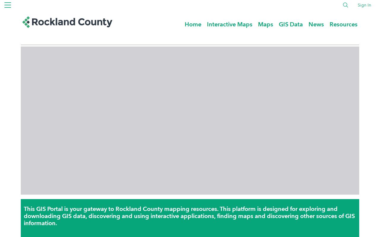
Use the displayed parcel and layers to organize the street pass, then retain the source URL and access date with the notes.
Rockland County Street Records by Address
Address-keyed sources overlap, but they answer different questions. The strongest street directory result records what the source actually establishes. The GIS map is geographic. An assessor card can identify an owner of record and distinguish a situs from a tax mailing address. A deed documents a recorded interest. Printed directories and voter records can add a dated address relationship within their own limits.
| Address record | Custodian | Coverage or use | Access path |
|---|---|---|---|
| Parcel map and Tax ID | Rockland County GIS | Mapped parcel, boundaries, districts, roads, and adjacent parcels | Public GIS viewer |
| Property card | Relevant town assessor | Owner of record, situs and tax-mailing distinctions when released | Municipal assessor request or inspection |
| Deeds and mortgages | Rockland County Clerk | Recorded parties, dates, legal descriptions, and instrument details | eSearch, counter, mail, or Archives Building S |
| Registration information | NY State and Rockland Board of Elections | Individual registration lookup or lawful records access | State form, local office, or applicable request process |
| Telephone and criss-cross books | New City Library Rockland Room | Dated printed name-and-address evidence | Library collection and local-history assistance |
| Historic maps and aerials | GIS, Archives, and map repositories | Building, parcel, or older street context | Online maps or local research appointment |
A mailing address should never be substituted for the property situs. An owner may receive tax mail elsewhere, and a person shown in an old directory may have no recorded ownership interest. Those differences are leads for later checks, not conflicts to erase.
Note: A parcel number anchors a location, but it does not turn a mailing or directory entry into proof of residence.
Follow Rockland County Street Deeds
The County Clerk records deeds, mortgages, satisfactions, and assignments. Once the parcel and legal description are known, use each confirmed party name in the grantor and grantee indexes. Capture the recording or document date, instrument or book-and-page identifier, legal description, transfer-tax or consideration clue, and any linked prior deed. Older instruments may rely on a lot, subdivision, metes-and-bounds description, or former road label instead of the current street name.
The County Clerk eSearch portal offers guest viewing for available images. Printing requires an account and is charged at the rate the Clerk publishes. The portal is an index and image access point, while the Clerk's land-record instructions also describe copy requests by PayIt, mail, and the rear search-room Information Desk.
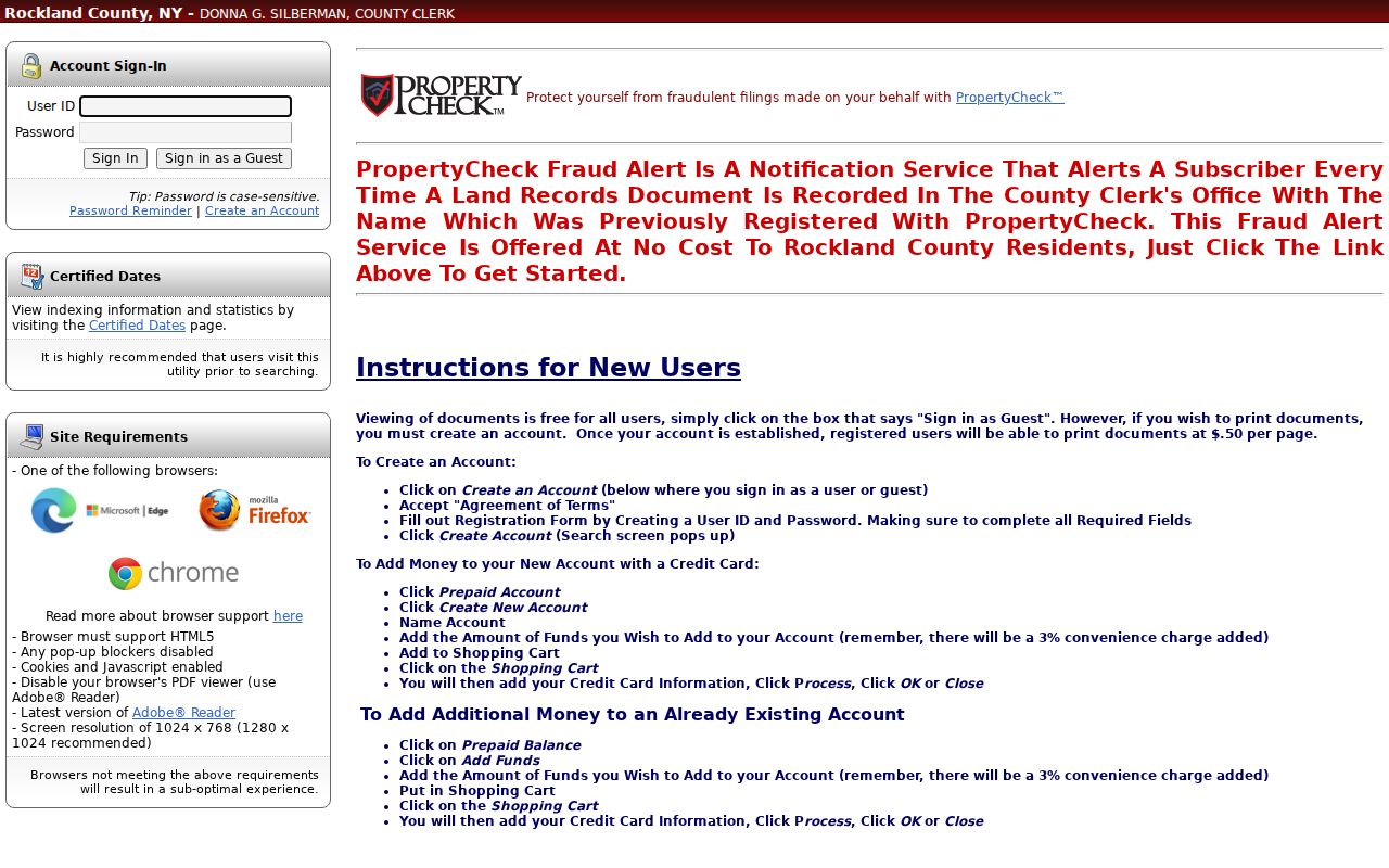
Guest access can help locate a document, but the document's legal description should still be compared with the parcel before it is placed in a street history.
For copies, the Clerk lists a $5 search fee plus $0.50 per page for an uncertified copy. A certified copy is listed at $5 per request plus $1.25 per page. Map copies are $5 each and use a search-room slip. These options matter when a street result needs a document rather than an index entry.
The Clerk's Certified Dates table distinguishes online categories from the larger archival collection. It displays online Land Records from January 2, 1930 through August 14, 2026, while the County Archives describes deeds and mortgages from 1798 forward.
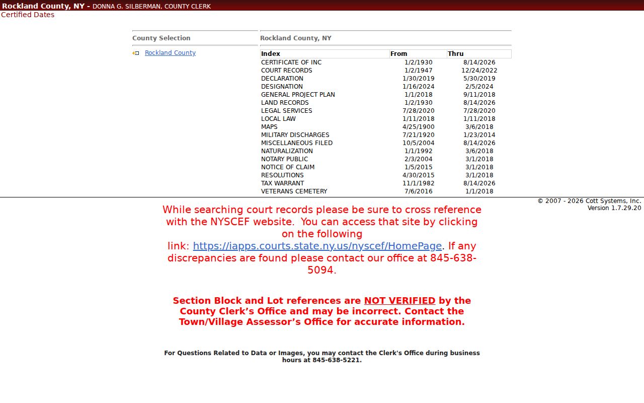
When the date falls outside online coverage, continue with the Clerk counter or Archives Building S instead of assuming the earlier record does not exist.
Read Rockland County Street Jurisdictions
A street directory search can change offices mid-road. Rockland has five towns and 18 villages, and a street can cross a town or village boundary even when its name remains unchanged. The municipality identified through GIS determines the assessor, local clerk, Justice Court, code office, and marriage-license routing. ZIP labels add another system. Bardonia and Nanuet share 10954, and a 10960 postal label can appear with Nyack or the Palisades Mall postal place.
Use the USPS ZIP Code Lookup to validate a delivery address. The form accepts company, street address, apartment or suite, city, state, and ZIP fields, and its city-and-state route can handle a postal-place check. USPS explicitly says that a ZIP result does not establish who is at an address.
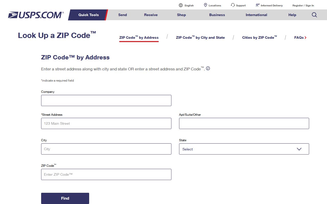
Pair the postal result with GIS before asking a municipal office for an address record. That prevents a mailing-place label from sending a search to the wrong custodian.
Note: Preserve the street, unit, postal city, ZIP, municipality, and Tax ID as separate fields because they serve different record systems.
Use Rockland County Street Directories
For historical street work, the New City Library's Rockland Room holds county telephone books from 1910 through 1998, earlier Nyack books from 1883 through 1890, earlier Haverstraw books from 1884 through 1890, and Cross Reference Directories from 1978 through 1999. A criss-cross directory reverses the usual path: it lets a researcher move from an address to a printed name. It is useful for building a dated household hypothesis, especially when a deed only names an owner.
Read the volume's year and page heading first. Copy the number and street exactly, record neighboring lines, then compare the next available edition. Initials, abbreviations, multiple units, and omissions are common. A one-year entry is evidence of a printed listing, not proof that someone remained at that address for a long period. The historical volumes themselves are described on the Rockland County Directory Book page.
The New City Library Rockland Room combines local directories with newspapers, obituary assistance, census resources, oral histories, photographs, and maps. Ask whether an undigitized volume is available rather than treating a catalog listing as online text.
Note: Copy the page number and edition year before comparing names because one address can appear differently across printed volumes.
Check Rockland County Street Registration Limits
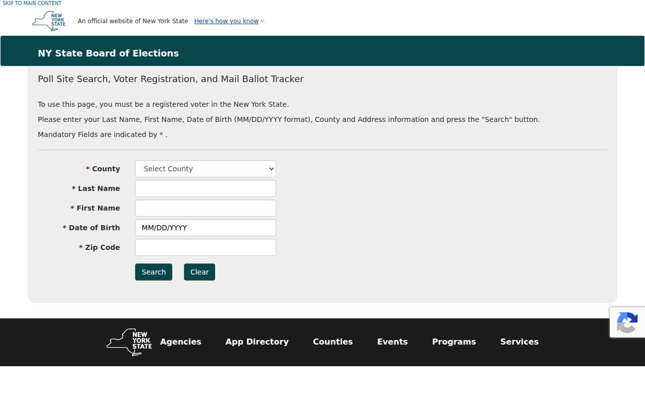
New York's voter form is designed for an individual to check registration and polling information. Its visible fields are County, Last Name, First Name, Date of Birth in MM/DD/YYYY format, and ZIP Code. Rockland is a county option, but the form is not a browsable countywide directory. A response is registration-related information, not proof that a person currently lives at an address or that every person at the property is listed.
The official NY Voter Lookup is shown below. It requires cookies and JavaScript, and no populated result was captured for the research, so a result layout should not be assumed.
For a lawful local request or a question the form cannot answer, contact the Rockland Board of Elections. State guidance requires an elections purpose for voter-registration data requests and prohibits non-election use of that data.
Compare Rockland County Street Maps
No authoritative countywide street-renumbering or renaming ledger was located. When an older address does not line up with a current parcel, compare the deed's legal description, Tax ID, municipal assessor history, postal city, historic maps, aerials, newspapers, and municipal-clerk records. Do not join two addresses simply because their street names look alike. The county has maintained GIS data since 1994 and assembled digital tax maps after 1987, while earlier tax maps were maintained by individual towns.
For historic Nyack, the 1896 Sanborn map can show building footprints, construction materials, uses, and street numbering. The 1876 Pearl River map and the Nanuet map in New York Heritage add named landowners, businesses, roads, and family plots. Historic county aerials include 1958, 1969-70, 1974, 1975-77, 1984 color, 1987, 2000 color, and 2001 color infrared. These maps give spatial context. They do not supply a present-day roster.
Rockland County Street Directory Terms
Keeping the record language straight makes a by-address trail easier to test. These terms describe different kinds of evidence and should not be treated as interchangeable.
- Parcel
- A mapped unit of land, usually tied to a Tax ID and boundaries rather than to a household.
- Situs address
- The property location. It can differ from an owner's tax-mailing address.
- Legal description
- The deed's land description, such as a lot, subdivision, or metes-and-bounds wording, used to confirm the property.
- Criss-cross directory
- A printed directory arranged by address so the researcher can work from a street and number toward a listed name.
Put these terms in separate evidence columns. That simple practice makes it clear whether a by-address result identifies land, a recorded party, or a dated household listing.
Respect Rockland County Street Privacy
A street directory can document a parcel, a recorded transaction, or a dated printed listing. It cannot reliably identify every person at a location, prove current presence, or override sealed and protected information. New York's Address Confidentiality Program permits eligible participants to use a substitute mailing address with state and local government. A missing result may reflect privacy protections, record maintenance, or a source that was never designed as a household list.
Lawful use. Use Rockland County address records for personal, lawful research such as family history, estate questions, or property context. Do not use an address trail to stalk, harass, intimidate, or harm anyone.
For an older paper file, the County Clerk archives and search-room process are the proper fallback. That route is more reliable than filling gaps with assumptions about a living person.